12 Apr Mapping & Photogrammetry
Mapping and Photogrammetry Made Easier
Drones, across the board, have changed the way that inspections are done. Amidst the varying degrees that tech has helped, drones have been able to create a solution that is more efficient than ever before. Mapping and photogrammetry, for instance, is a critical part of inspections of land, property and more. These elements are critical for figuring out what is going awry, and what elements are needed for fixing, upgrading, and doing all sorts of different work.
Mapping With Efficiency
Factoring the most important part that should be taken into consideration is the mapping element. Drones can be dispatched and get an aerial view of large areas of land. These can be flown across a great deal of square footage, and is far more efficient than other solutions. Take into account the traditional options from the past. Surveyors, for instance, would have to send crews across large areas of land.
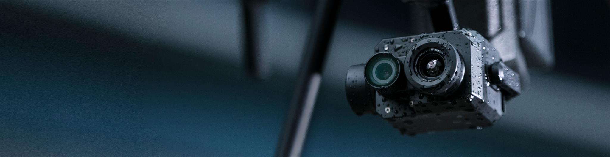
With a more efficient mapping technique, drones have made it so that companies can save money and time on getting a large survey of land without having to sacrifice quality. Tech of this type is equipped with high definition cameras. The cameras are not just focused on photographic solutions, but can also take full motion video, high definition elements and much more. Within an afternoon, in a few hours, or less, a drone could capture more mapping solutions than that of individual crews going across terrain and mapping every element overall.
Photogrammetry And Accuracy
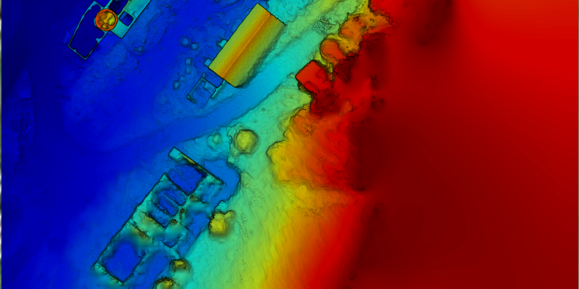
Another aspect of drone technology made for large scale inspections, is that of photogrammetry. This is a solution that is quite advanced, and it uses lasers, and UAV, alongside Light Detection and Ranging. This is also know as Lidar, and it is one of the best options that comes with modern drone technology. This can capture hundreds of square miles per day, and can measure points across maps and create 3D modeling solutions, alongside terrain, and landscape solutions. This can move towards several layers of the earth, giving crews an incredible view of the density, vegetation, canopy, and more. This allows for easy categorization, monitoring changes, and focusing on larger scale projections.
Inspections Across Industries
There are several uses for photogrammetry, lidar, and much more. In regards to inspection solutions, drones can help with inspecting pollution, flood, urban planning, oil rigs, quarry mining, archeology, and even cellular network towers. Inspecting, surveying, mapping, and fixing elements across these areas can take on a lot of man hours, and crews to get things done properly. It can become so difficult that some companies find themselves dealing with a variety of issues overall.
Cameras that are mounted on modern drones do more than just take high definition pictures, they can shoot in RAW formatting, focus on depth-of-field, as well as capturing near infrared solutions and much more. It’s something that is not isolated to just “one” option, and experts in the field are finding out that the software and elements used in conjunction with drone technology makes inspections, construction, land surveying and more a lot easier to manage. Not only that, it’s cost effective, which is always a plus for business of all sizes.